Tuesday, October 28, 2008

The Hammers (Johnson Valley, CA) Needs Us

FOR IMMEDIATE RELEASE

Contact: Kurt Schneider

E-mail: kurtuleas@pirate4x4.com

El Dorado County: October 28, 2008

Pirate4x4.com unveils online letter generator to fight for OHV access
Pirate4x4.com uses newest campaign for Johnson Valley and the Hammers to announce letter generator.

The largest Off-Road website in the world, Pirate4x4.com has added a new tool for OHV enthusiasts to voice their opinions on route closures across the nation.

Piate4x4.com's new letter generator will enable Off Highway Vehicle (OHV) enthusiasts of all types to send out letters via e-mail to many different decision makers at once. Unlike many "form letters' campaigns that have been used in the past, this new letter generator allows users to type their own personalized letters and then send them off to several pre-determined e-mail addresses at once.

The current Pirate4x4.com letter campaign with the generator focuses on the United States Marines Corps expansion in to the Johnson Valley OHV area in Southern California. The Johnson Valley area is currently maintained by the BLM, and it contains the Hammers trail system which is considered a "Mecca" for OHV enthusiasts. The area is also used by many different types of recreationists including a broad range of motor-sports and hobbies; motorcycle and MX enthusiasts, ATV riders, sand-buggies, rally cars, hikers, campers, rock-hounds and RV-ers. Johnson Valley is also the home to the famous "King of the Hammers" 4x4 race that is held every year in the valley as well as many other sanctioned desert races.

The Marine Corps base at 29 Palms is now proposing a land withdrawal of 180,000 acres from the BLM in order to increase its training facilities for live-fire drills. This expansion would effectively shut the public out of this area and erase one of the most important trail systems for OHV users off the map forever.

This particular effort is not the first time Pirate4x4.com members have been active in land-use issues. The Pirate4x4.com letter generator has also been used for several issues important to the OHV community including addressing the Boxer/McKeon Wilderness Bill, The Greenhorn OHV area, and helping to defeat a Smokey the Bear OHV public service announcement that portrayed OHV users in a bad light.

On March 12, 2008, the website also held a "virtual rally" to show opposition to the proposed expansion. During a 4-hour period, almost 1,500 participants voiced their opinion while over 27,000 views of the rally were registered. In the first hour of the rally, traffic on the website was so heavy that many rally participants could not log onto the website to voice their concerns, post family photos, and pleas for its traditional uses to be left alone. The rally thread currently has been viewed by over 57,000 people. To view the rally responses, please visit www.pirate4x4.com/jv

Pirate4x4.com is the largest off-road website in the world with over 110,000 members and a million visitors to the website a month.

The Pirate4x4.com letter generator can be found at: www.pirate4x4.com/letters

###
If you would like more information on this topic, or to schedule an interview with Kurt Schneider, e-mail Kurt at kurtuleas@pirate4x4.com

 

Friday, October 24, 2008

Off-Road Expo, Pomona, CA 2008


Off-Road Expo in Pomona, CA is an awesome consumer show for enthusiasts as well as businesses, vendors and dealers. But for us, the buyer and looker, this is one heck of a show.


Held every October in Pomona, CA, it's a must see for me. I go in my capacity as a BlueRibbon Ambassador to help ensure the future of our sport, while supporting those businesses that are members of BlueRibbon. Check out the rock crawling, celebrities, and new products in this photo essay (pics):


http://www.delalbright.com/Articles/expo_2008.html


Del

Thursday, October 23, 2008

Dutch Oven Cooking (from Tom Severin)

Tickle The Taste Buds With A Dutch Oven

Dutch ovens are a great way to bring the taste of home cooking to the outdoors. To better understand Dutch ovens, I turned to fellow Outdoor Adventure USA member Bruce Crabtree. Bruce has been cooking with Dutch ovens for over 15 years. He recently joined us during a ham radio program to share his thoughts. To hear the entire program, click on this link:
http://www.oausa.net/on-air-nets/48-on-air-nets/91-cooking-with-a-dutch-oven


A Dutch oven is actually a cooking pot that's designed to be heated by charcoal or a campfire. They are made of cast iron because iron offers a uniform distribution of heat. Dutch ovens are most often used for baking goods, but are also used to cook with. People make soups, casseroles, and other dishes with a Dutch oven.

Dutch ovens can be purchased at most outdoor stores such as Cabela's, Sports Chalet and Bass Pro. Wall Mart has a limited selection. Stick with high quality Lodge or Camp Chef brands.

The ovens come in a variety of sizes, with the most common being 10" and 12" wide. A 12" pot holds six quarts of food and will serve four to six people. For two to four people, a 10" pot should be sufficient. Be sure you purchase a "camp" oven with 3 little legs and a lip on the lid to hold hot coals.

New ovens have a waxy coating to prevent rusting. Wash in soap and water to remove the coating. The next step is to "season" your pot. Use a paper towel to apply a light coat of vegetable oil (many people use Crisco brand) to all surfaces of the pot and lid inside and out. Do not use lard or other animal fat. It will turn rancid over time.

Place the covered pot in your gas grille, close the lid, and heat to 425 degrees, baking for one and one-half to two hours. This process causes a lot of smoke, so don't be alarmed. Season several times to give your oven a nice, non-stick surface.

Now you're ready to cook. Since most folks use charcoal we'll focus on that. To determine how much charcoal to use, remember the "plus 3/minus 3" rule. Add three coals to the size of your pot for the lid. Subtract three to get the number of coals needed underneath. So, for a 12" pot, you'd use 15 briquettes on the lid and nine underneath.

Form a ring of charcoal under the pot; do not have any coals directly underneath or you'll develop a hot spot. That's not important for the lid. Coals can be placed evenly across the top. This arrangement will create an internal temperature of about 350 degrees. Add charcoal if you need a higher temperature. Each additional briquette increases the internal temperature by about 25 degrees.

Most dishes and baked goods cook in 45 minutes to an hour. Rotate the oven every 15 minutes to ensure even heating, and be careful when serving your meal. The oven is heavy and very hot.

Some Do's and Don'ts to consider:

  1. Do clean out the pot after every meal. Condensation will form on any leftover food, which will cause the pot to rust. A paper towel is usually all you'll need to remove food scraps.
  2. Don't store without drying. Wipe it thoroughly with a towel or heat the oven over a stove.
  3. Don't clean with soap. The porous surface of the oven will capture some of the soap, resulting in an after taste. If the oven has been cleaned with soap, rinse it thoroughly with hot water.
  4. Don't use steel wool or abrasive cleaners. These will scratch off the seasoning and make the oven susceptible to rusting. However, you can use steel wool to remove rust spots.


Dutch ovens are a great way to bring authentic cooking to the outdoors. With a little practice you can become a hit with your friends during your next off-road adventure.

##########################


I am attending the SEMA show in Vegas on November 4th. Let me know what stuff you are interested in having me look for. I can't promise anything but it might happen if I know in advance!

##########################


There are 3 more clinics that will pretty much wrap up the year.

The last Sand Clinic is at Pismo on November 22nd. Sign up now. http://www.4x4training.com/TrainingClinics/sandclass.html
Sand is way different then dirt and rocks. Come and learn what we have taught those who rescue people on the sand with life threatening injures.

The Winch Clinic is Friday December 5th. We always hold them on a weekday to lessen the risk of someone running over our lines and hurting themselves. http://www.4x4training.com/TrainingClinics/Winch.html

This clinic will take you from basics to advanced. Most winch owners seldom use their winch and do not have the experience necessary to use it within safety limits. This clinic will give you all you need to be safe and to extract yourself from an extreme stuck!

The Rocks Clinic is December 22nd. It will be held at Calico Mountains near Barstow. This is the course and route highlighted in the September 2008 issue of Perterson's 4 Wheel magazine – "Practice Makes Perfect" by Kevin McNulty. Sign up at http://www.4x4training.com/TrainingClinics/Rock.html

##########################


I hope to see you on the trails!

Tom Severin, President
Badlands Off Road Adventures, Inc
4-Wheel Drive School
310-374-8047
http://www.4x4training.com
Make it Fun. Make it Safe.

###

Tahoe Forest Plan Meeting in CA Bay Area

Tahoe National Forest OHV Meeting scheduled October 29 in Bay Area

By Amy Granat

Meeting to be held Wednesday, October 29, 2008 at 6:30 PM in Pleasant Hill, CA

Off Highway Vehicle users have only one chance to affect the outcome of Route Designation in their favorite forest. The time for the Tahoe is now! If you ride or drive a motorcycle, ATV or 4WD you must attend.

To help you understand the Forest Service proposed plan, Friends of Tahoe Forest Access (FOTFA) is sponsoring a meeting in the Bay Area with representatives from the Tahoe National Forest. Tahoe Forest officials will give a presentation of their proposed plan and answer questions from the audience. Maps may be reviewed for 30 minutes before the presentation.

Link to Tahoe National Forest proposed actions and Draft Environmental Impact Statement:
http://www.fs.fed.us/r5/tahoe/projects_plans/ohv_inv/DEIS_overview.shtml

This is an important event - the Forest Service didn't put on a meeting for Bay Area residents to ask questions and become informed, so FOTFA, along with the CORVA Comments Project Team and Bay Area OHV clubs put together this meeting for OHV users in the Bay Area.

Come, ask questions, and get involved. If you want to make a difference, you must be informed first! 

Location:
Pleasant Hill Senior Center
233 Gregory Lane
Pleasant Hill, CA 94523
(Parking available in rear)

Get more info on cal4wheel.com

Monday, October 20, 2008


My latest photography is of the famous and mystical Sand Tufa of Mono Lake, CA. Being there is somewhere between Disneyland and a dreamworld of structural fantasy. You won't believe this "rock" and sand formations along the sandy shoreline of Mono Lake.
Check it out:

http://www.delalbright.net/Images/Tufa/index.html

thanks, let me know what you think,
Del

San Bernardino Forest (CA) Releases EA for Motorized Travel

BLUERIBBON COALITION ACTION ALERT!

Dear BRC Action Alert Subscriber,

San Bernardino National Forest Releases EA For Motorized Travel Plan

The San Bernardino National Forest, located in southern California, has just released their Draft Environmental Analysis (DEA) for the Motorized Travel Management project. The Forest Service (FS) will be accepting comments for the next 30 days.

This project will make limited changes to the Forest's motorized transportation system and implement the 2005 Travel Management Rule. If you would like to review the DEA in detail, an electronic copy on their website: http://www.fs.fed.us/r5/sanbernardino/projects/ohv.shtml. A copy of the DEA is also available for view at the San Bernardino National Forest Supervisor's Office.

The three action alternatives that are presented in the DEA combine many of the comments and recommendations that have been provided at public meetings and from other contacts. This is your opportunity to examine the details about the project, including measures designed to protect resources or alleviate potential problems you may be concerned about. The release of the DEA begins the formal comment period, during which the FS will consider all public comments before issuing a decision.

Written, facsimile, hand-delivered, and electronic comments concerning this action will be accepted until November 13, 2008.

THE COMMENT DEADLINE IS NOVEMBER 13, 2008

Mail written comments to:

          San Bernardino National Forest
          Attn: Richard Thornburgh, Environmental Coordinator
          602 S. Tippecanoe Ave.
          San Bernardino CA 92408.

The office business hours for those submitting hand-delivered comments are: 8:00am - 4:30pm Monday through Friday, excluding holidays.

Email comments to: 
         
comments-pacificsouthwest-san-bernardino@fs.fed.us

Electronic comments must be submitted in a format such as an email message, plain text (.txt), rich text format (.rtf), or Word (.doc). Please put "Travel Management" in the subject line.

Fax comments to:
          (909) 383-5586.

If you have any further questions about this project, please contact Richard Thornburgh, Environmental Coordinator, at 909-382-2642.

JUST REMEMBER, PUBLIC INVOLVEMENT IS CRUCIAL TO KEEP RECREATION AREAS OPEN, PLEASE GET INVOLVED!

Thanks in advance for your support,
Ric Foster
Public Lands Department Manager
BlueRibbon Coalition
208-237-1008 ext 107


Get BRC's Latest News & Alerts via RSS!
http://feeds.feedburner.com/BlueRibbonCoalition

Klamath National Forest, CA/OR, Seeks Comments

BLUERIBBON COALITION ACTION ALERT!

Dear BRC Action Alert Subscriber,

Klamath National Forest Seeks Comments on Motorized Routes

The Klamath National Forest, located in northwestern California, is formulating a new travel plan that will limit ALL vehicle use to designated roads, trails and areas. On October 7, 2008, the Notice of Intent (NOI) to prepare an Environmental Impact Statements (EIS) was published in the Federal Register, beginning the formal NEPA (National Environmental Process Act) analysis for the Motorized Travel Management project.

The NOI initiates the scoping process, which guides the development of the EIS. The purpose of the NOI is to invite the public to participate in the Travel Management Project EIS analysis by providing comments about the proposal during the public scoping process. The Forest Service (FS) is asking for your input during the 30-day public scoping comment period.

Although comments are welcome throughout the planning process, providing your comments by November 6, 2008, will allow time for the Klamath National Forest to consider the input during the analysis and in developing alternatives. Completion of the Draft EIS is expected in May 2009, followed by another 45-day comment period.

The Forest urges the public to review the NOI and associated maps and tables at the following website before commenting: http://www.fs.fed.us/r5/klamath/projects/ohv/index.shtml. A copy of the NOI will be provided upon request. 

Send written comments to:
          Route Designation Team
          Klamath National Forest
          1312 Fairlane Rd.
          Yreka, CA  96097

Electronic comments, acceptable in plain text (.txt), rich text (.rft), or Word (.doc), may be submitted to comments-pacificsouthwest-klamath@fs.fed.us.  Please put "Route Designation" in the subject line. 

For more information, contact Emelia Barnum, Project Leader, by phone:  (530) 841-4470.

JUST REMEMBER, PUBLIC INVOLVEMENT IS CRUCIAL TO KEEP RECREATION AREAS OPEN, PLEASE GET INVOLVED!

Thanks in advance for your support,
Ric Foster
Public Lands Department Manager
BlueRibbon Coalition
208-237-1008 ext 107


Get BRC's Latest News & Alerts via RSS!
http://feeds.feedburner.com/BlueRibbonCoalition

Tuesday, October 14, 2008

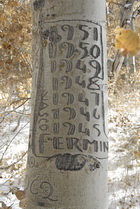
Photography of Aspen Bark Carvings from Spanish sheep herders


While cruising for photos up on Highway 89, Monitor Pass, central Sierra Nevada of California, I found an aspen tree (quakies) grove full of historical and interesting carvings from the old days. Some of them dated back to the early 1900's. Awesome stuff. Fun to explore.


Check out my photos here: http://www.delalbright.net/Images/Aspen/index.html

Thursday, October 9, 2008

Rubicon Trail Update from Trail Boss; 10/8/08

Today was the monthly meeting of the Rubicon Oversight Committee (ROC) and here are some highlights from my notes:


  1. Bridges on the trail: with grant money and leadership from the great folks at the Dept. of Transportation in Eldorado County (DOT), we are in progress of getting two bridges on the trail. One at Ellis Creek and one at Gerle Creek (Wentworth Springs Road). These will prevent future closures and environmental issues with both these critical watersheds. It will be summer of 2010 before we see these constructed, but the good news is that everyone is on board and excited about having bridges to help us keep our trail open and healthy. Our input will be asked for as the design ideas come forward.
  2. US Geological Survey folks are out on the trail right now doing some analysis of future maintenance jobs that need to be done to keep our trail in good shape. They are doing this under guidance from Eldo County, so we hope to have a good report and what all we'll be doing these next two summers.
  3. Loon Lake Toilet: the CXT (big vault pre-fab) toilet is set to be installed in the next week or so at Loon Lake (staging area). The hole is prepared and ready to accept the new toilet system. Again, we are using grant money and the guidance and supervision of the good folks at Eldo County DOT.
  4. USFS Fire Restrictions have been lifted on the Forest – so camp fires are ok now. Go prepared if you go up; frost is heavy in the mornings. J


Before turkey day I'll probably be checking for a good date for our Spring FOTR meeting (most likely February). More on this soon, but in case you're wondering, yes, for sure, I'll be happy to continue as your Trail Boss. We'll have the normal annual election at the spring meeting. 2009 promises to be an awesome year for Friends of the Rubicon. For more on the Rubicon Trail, visit http://www.delalbright.com/Rubicon/rubicon.htm

Del

Wednesday, October 8, 2008

Water (drinking) for your Trail Rig (the Hydra)


I can't say enough about having water with you at all times, for your safety and health. Water is the best thing going for us. So OK, it's not the only thing in your ice chest – but it's the most important. And if you want more room in your ice chest, plus want more water along, you gotta get one of these Hydra goodies.

The Hydra from Rompalicious is a perfect alternative to all those pesky water bottles that flop all over the place and out onto the trail without notice. The Hydra holds two and a half gallons of fresh water and straps easily to the back of the seat or on a roll bar so it takes up a lot less room than all those plastic bottles which makes it easier to store more important things like tools and extra parts. 

Read my whole write up on the Hydra from Rompalicious right here:

http://www.delalbright.com/Products/products_emergency.html

Tuesday, October 7, 2008

JPCooler – the soft sided ice chest for your rig


JPCooler for All Jeepers

JPCooler has designed and creating the first and only tailor made cooler for the Jeep Enthusiasts. We run JPCoolers on our Jeep and love the versatility and utility they provide, let alone the cooling factor. Sometimes we run one for just dry goods even. It all depends on the wheeling trip.


Read more of our review of this great product here.

JK New Roof Rack from Olympic4x4 Products


Olympic4x4 Products Unveils New Dave's Rack for Jeep JK

The Side-to-side Generation

At the Pomona Off-Road Expo in October 2008, David and Eric Lichtbach of Olympic4x4 Products unveiled the prototype of their new JK Jeep Wrangler Dave's Rack, with side departure and free-standing shade possibilities.

Instead of deploying to the rear of the Jeep like the old TJ Dave's Rack, this new JK roof rack goes to either side of the Jeep. Talk about sweet!

Read more about this side-to-side JK roof rack here.

Being Prepared in an Emergency (on the trail)


Surviving On the Trail

Getting through and making the best of it


By Stacie & Del Albright


Stacie tells the story of a tow strap time to this day. "When I heard the tell-tale sound of the axle snapping as we came down hard on the passenger side into a four foot crevice, I muttered a few words to myself. The summer sun had been sinking lower in the fading blue sky for some time and with our buddy dangling from a tow strap behind us I knew we were in trouble. We were going to be there for awhile."


Read more about the Ready Freddy and The Hydra from Rompalicious here.

Monday, October 6, 2008

Article: How to Read a Map – Staying Alive

Know How to Read a Map, and You May Stay Alive

By Tom Severin, Badlands Off Road Adventures


It's easy nowadays to rely entirely on a GPS receiver to direct you during a trip. Just program in your destination, and let the friendly voice and digital map guide you along the way. But like any electronic gadget, a GPS unit has its limitations, and you can end up in trouble if you're not careful. Plus, they can lose power or break, leaving you stranded if you don't have a back up.


GPS units are of limited use when you're driving off road. The maps and other data they provide tell you how to get from Point A to Point B, but they say nothing about the quality of the roads. This became painfully clear to a group that was traveling in the Grand Staircase-Escalante National Monument in early August. Instead of a leisurely ride, these folks found themselves being led down the wrong roads, many of which were barely passable, and way off course. They ended up at the edge of a cliff, where they spent the night before being rescued.

The GPS system offered what appeared to be the most obvious route, which normally is the most direct, but it could not account for the quality of the roads. Their vehicles got stuck in sand, and in their attempt to backtrack they ran low on gas. But they were lucky: they got out alive.

Driving off road requires more than just a command of a 4WD vehicle. You need a good topographical map to help you navigate that difficult terrain. Available from numerous retailers, a topographical map shows various features such as hills, streams, and gullies, and provides a better idea of the paths and roads you'll encounter. If you don't know how to read a topographical map, I suggest you find someone who can teach you.

One of the best topographical maps is the 7-1/2 minute series published by the United States Geological Survey (USGS). This is a very detailed map at a scale of 1:24,000. Most GPS mapping software is based on the work of the USGS.

If you are used to using latitude/longitude formats with your GPS in degree, minutes, and seconds, you should become familiar with the UTM (Universal Transverse Mercator) system. It makes pin pointing your location on a map (or vice versa) much easier.

The 7-1/2 minute maps also show UTM grid lines, which help you calculate the coordinates of your position. The UTM system divides up the entire planet into a series of grids six degrees wide by eight degrees tall. Each grid is referenced by a two-digit number representing the east-west direction and a letter that designates north-south direction. (For example, most of southern California is in UTM sector 11S.) Every location in the grid is measured north in meters from the equator and east in meters from a point west of the grid.

It might take awhile to grasp the entire concept, but fortunately you don't need to in order to use UTM. You'll notice tick marks along the edges of your map. These divide up the map into section 1,000 meters on a side. By overlaying a more detailed grid pattern, available through various stores, you can create subsections that are a mere 100 meters on a side.

A careful reading of the values of the east-west and north-south grid lines will give you the approximate coordinates for your location. Close enough, anyway, to lead rescuers to you and your family.

GPS receivers are extremely helpful for most trips. Heck I rely on the one in my vehicle to get me around the state and even out east to see my kids. But you shouldn't rely entirely on one when you're off road. Learning how to read a topographical map and calculate a location–which aren't hard to do–can literally be a life saver, and bring a lot of peace of mind to your next off-road adventure.

------------------------------------------------

If you hurry, you can still sign up for one of the Mojave Desert trips.

Mojave Road October 9-11        http://www.4x4training.com/tours/mojaveroad.html

Death Valley October 12-15       http://www.4x4training.com/tours/Deathvalley.html

Mojave Expedition Oct 9-15       http://www.4x4training.com/tours/MojaveDesert.html

I hope to see you on the trails!

Regards,

Tom Severin, President
Badlands Off Road Adventures, Inc
4-Wheel Drive School
310-374-8047
http://www.4x4training.com
Make it Fun. Make it Safe.
_________________________________________________________________

Tom Severin, 4x4 Coach, teaches 4WD owners how to use their vehicles safely and confidently over difficult terrain in adverse conditions. Visit www.4x4training.com to develop or improve your driving skill.

Copyright 2008, Badlands Off-Road Adventures, Inc.

###

The Hammers (Johnson Valley) Meetings Announced

BLUERIBBON COALITION ACTION ALERT!

Dear BRC Action Alert Subscriber,

BLM Announces Public Meetings for Marine Corps Withdrawal of Public Lands

The Bureau of Land Management (BLM) and the Marine Corps have announced that they will be holding two public hearings in late October. The meetings will be about the proposed transfer of approximately 366,000 acres public land, including approximately 189,000 acres of Johnson Valley OHV Area, from the BLM to the Corps.

As most of you already know, the transfer of these public lands would be devastating to the OHV community and recreating public. It's time to step up and let them know where you stand. Please try to attend one if not both of these meetings. See the BLM press release with the dates and locations of each meeting below.

Thanks in advance for your involvement,
Ric Foster
Public Lands Department Manager
BlueRibbon Coalition
208-237-1008 ext 107

______________________________________________________

News Release

For Release: September 23, 2008                   
Contacts:   Stephen Razo (951) 697-5217; e-mail
srazo@ca.blm.gov
CA-CDD-08-68

Public Meetings Set in Twentynine Palms and Victorville for Marine Corps Withdrawal

The Bureau of Land Management (BLM) and the Marine Corps will host public meetings in Twentynine Palms and in Victorville next month to help the public understand the legislative withdrawal process for consideration of the proposal to expand the Twentynine Palms Marine Corps Base in San Bernardino County.

The first public meeting is scheduled for October 23, 2008 at Hay's Gym, Twentynine Palms Junior High School, 5798 Utah Trail, Twentynine Palms, Calif. from 4 to 9 p.m. The second meeting is the following day, October 24, at Hilton Garden Inn, 12603 Mariposa Road, Victorville, Calif.  Two meeting times are scheduled at the Victorville location, 1:00 p.m. to 4:00 p.m. and 6:00 p.m. to 9:00 p.m.  Both meetings are scheduled to provide the public the broadest opportunities to attend, according to Roxie Trost, BLM Barstow Field Manager.

A notice published September 15 segregated the public lands involved for two years, making them unavailable for settlement, sale, and location of claims under the mining laws.  However, the lands remain open to public access and recreation use.  A 90-day comment period closes December 15, 2008.

The notice, available online at www.blm.gov/ca also explains the withdrawal process.  After the comment period, the Marine Corps will be preparing a draft environmental impact statement (EIS) for further public review to identify a range of alternatives for meeting the Corps' training requirements and analyzing the environmental impacts.

"We realize members of the public have concerns and questions about the proposed withdrawal and what the segregation means," said Trost.  "These meetings will provide a first-hand opportunity to have the proposal and subsequent opportunities for full public involvement explained," she said.

The Department of the Navy, as required by the 1958 Engle Act, filed an application requesting the Secretary of the Interior to process a proposed withdrawal of public lands for military training and exercises involving the Marine Corps Air Ground Combat Center at Twentynine Palms.  The proposal seeks to withdraw approximately 366,000 acres of federal public land and, if eventually acquired, approximately 72,000 acres of non-federally owned property within the proposed withdrawal area. 

-BLM-


Get BRC's Latest News & Alerts via RSS!
http://feeds.feedburner.com/BlueRibbonCoalition